Rapid Assessment Program

Leading the charge to discover, describe and protect nature

The variety of life on Earth comprise millions of species and underpin the well-being of human societies. Knowledge about these ecosystems is our strongest tool to ensure the future of life on our planet — yet much of the natural world remains poorly known and unexplored.

Our role

Conservation International’s Rapid Assessment Program (RAP) works to fill this void. RAP, founded in 1990, sends teams of experts on short expeditions into critically ​important field sites around the world. Experts at these sites evaluate the state of a region’s biodiversity, the health of its ecosystems and the multiple benefits that nature provides to people. By doing so, RAP provides information that can guide effective conservation decision-making.

Our plan

Today, RAP is evolving and expanding its scope. Building on the program’s legacy of discovering and assessing species, our strategy for RAP now integrates our understanding of the vital links among biodiversity, healthy ecosystems and human societies.

RAP surveys help provide the scientific foundation to:

  • Assess ecosystem health, identify threats and track the status of threatened and key species, including discovery of species new to science
  • Design, create and manage effective protected areas
  • Work with communities to develop community-based conservation initiatives
  • Sustainably manage negative infrastructure and business impacts on nature
  • Understand impacts of climate change on biodiversity
  • Support sustainable management of wild food sources and other ecosystem services (e.g., fresh water, carbon)
  • Train the next generation of scientists and conservationists
  • Engage and inform stakeholders, policymakers and the public

20M hectares

RAP has supported the creation, expansion and improved management of more than 20 million hectares (nearly 50 million acres) of marine and terrestrial protected areas — in addition to the discovery of more than 1,750 species new to science.

Standard field research takes years, but political leaders will not usually wait that long to make decisions affecting the most biologically important areas of Earth. RAP gathers relevant scientific information quickly enough to aid in protecting such places from irreversible damage that can occur on a very short time scale.”

Murray Gell-Mann, Professor, Santa Fe Institute, and 1969 Nobel Prize recipient

What we measure

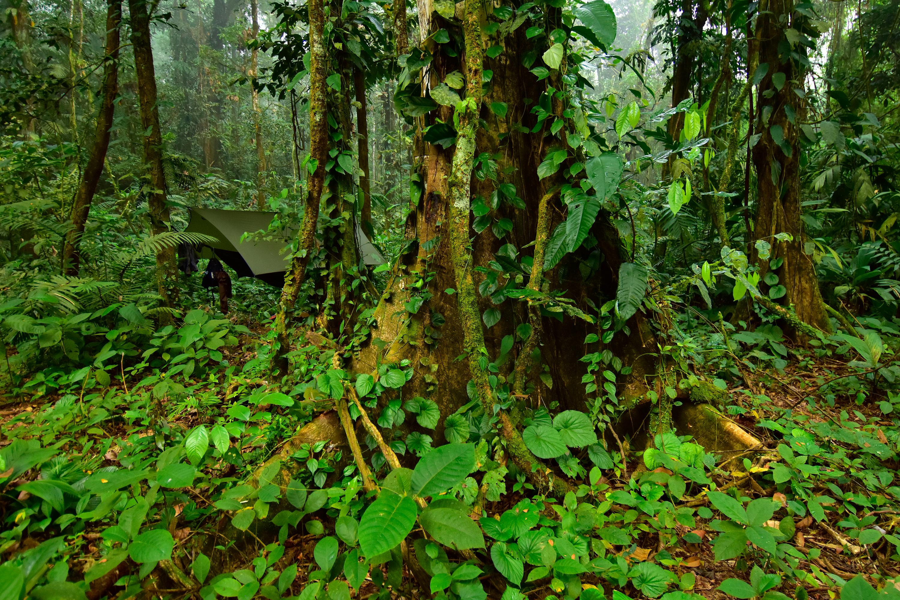
We work in rivers, rainforests, coral reefs and many other habitats around the world, often in remote, unexplored regions. RAP combines field surveys (usually lasting 2-4 weeks) that utilize cost-effective, standardized methods, innovative technologies and state-of-the-art analysis and planning. Consistent application of core standardized methods is essential for monitoring species abundance and population trends, enabling comparisons across time and space, and reducing researcher bias. Recognizing that conserving biodiversity is fundamental to maintaining healthy ecosystems and the services that nature provides to people, we measure:

Biodiversity

We measure biodiversity attributes such as:

  • species richness and abundance;
  • species new to science;
  • threatened and endemic species;
  • indicator, keystone and flagship species; and
  • species important to human livelihoods.

Ecosystem health and services

We also measure ecosystem health and services, including:

  • habitat diversity, quality and structure (e.g., forest intactness, coral health);
  • wild food, medicines, building materials and other provisioning services;
  • water quality and flow;
  • watershed connectivity; and
  • forest carbon stocks.

Socio-economic, cultural and sustainable management data

Finally, we collect social and cultural data such as:

  • the demography, livelihoods and needs of local communities;
  • threats to natural resources; and
  • options for sustainable management.

Timely, mobile science at scale

RAP provides the mobile, flexible and cost-effective tool required to generate the scientific data needed to protect nature and its benefits to people. RAP provides field data needed for conservation planning at the local to regional scale where many threats occur. In these cases, existing data and global datasets are sparse and insufficient. RAP also provides quick yet highly-informative descriptions of the ecological and social values of specific and often unknown areas, placing them within a global context to guide conservation priorities and improve conservation investments. The rapid nature of these assessments is intended to provide the information necessary to catalyze conservation action within a timeframe suited to decision-makers.

RAP expert scientists act as an ecological SWAT team to accurately assess the biodiversity and health of an ecosystem in a fraction of the time it would normally take.”

Peter Seligmann, Conservation International Board Chairman Emeritus

Related Resources

RAP 1 – Alto Madidi, Bolivia, 1990RAP 2 – Cordillera de la Costa, Ecuador, 1992RAP 3 – Columbia River Forest Reserve, Belize, 1993RAP 4 – Santa Cruz, Bolivia, 1993RAP 6 – Tambopata-Candamo Reserved Zone, Peru, 1994RAP 7 – Cordillera del Cóndor, Ecuador and Peru, 1997RAP 8 – South Central Chuquisaca, Bolivia, 1997RAP 9 – Lakekamu Basin, Papua New Guinea, 1998RAP 10 – Parque Nacional Noel Kempff Mercado, Bolivia, 1998RAP 11 – Milne Bay Province, Papua New Guinea, 1998RAP 12 – Cordillera de Vilcabamba, Peru, 2001RAP 13 – Parc National de la Marahoué, Côte d'Ivoire, 1999RAP 14 – Northwestern Irian Jaya, Indonesia, 2000RAP 15 – Upper Río Orthon Basin, Pando, Bolivia, 1999RAP 16 – Laguna del Tigre National Park, Petén, Guatemala, 2000RAP 17 – Calamianes Islands, Philippines, 2000RAP 18 – Pantanal, Mato Grosso do Sul, Brasil, 2000RAP 19 – Río Paraguay Basin, Alto Paraguay, Paraguay, 2001RAP 20 – Togean and Banggai Islands, Sulawesi, Indonesia, 2001RAP 21 – Southern New Ireland, Papua New Guinea, 2001RAP 22 – Raja Ampat Islands, Indonesia, 2002RAP 23 – Réserve Naturelle Intégrale d’Ankarafantsika, Madagascar, 2002RAP 24 – Pampas del Heath, Perú; Alto Madidi, Bolivia; Pando, Bolivia, 2002RAP 25 – Yongsu - Cyclops Mountains and the Southern Mamberamo Basin, Papua, Indonesia, 2002RAP 26 – Eastern Kanuku Mountains, Lower Kwitaro River, Guyana, 2002RAP 27 – Okavango Delta, Botswana, 2003RAP 28 – Aquatic Ecosystems of the Caura River Basin, Bolívar State, Venezuela, 2003RAP 29 – Milne Bay Province, Papua New Guinea—Survey II, 2003RAP 30 – Ecosistemas Acuáticos en la Confluencia de los ríos Orinoco y Ventuari, Estado Amazonas (Venezuela), 2006RAP 31 – Coral Reefs of Northwest Madagascar, 2005RAP 32 – Mantadia-Zahamena corridor, Madagascar, 2005RAP 33 – Aquatic Ecosystems of the Pastaza River Basin, Ecuador and Perú, 2005RAP 34 – Two Classified Forests in South-Western Côte d’Ivoire, 2005RAP 35 – Forêt Classée du Pic de Fon, Simandou Range, South-eastern Republic of Guinea, 2004RAP 36 – Draw River, Boi-Tano, Tano Nimiri and Krokosua Hills forest reserves, Ghana, 2005RAP 37 – Orinoco Delta and the Gulf of Paria, Venezuela, 2004RAP 39 – Coppename River Basin, Suriname, 2006RAP 40 – Three Classified Forests in Southeastern Guinea, 2006RAP 41 – Boké Préfecture, Northwestern Guinea, 2006RAP 42 – Mont Panié, Province Nord, Nouvelle Calédonie, 2006RAP 43 – Lely and Nassau Plateaus, Suriname, 2007RAP 44 – North Lorma, Gola and Grebo National Forests, Liberia, 2007RAP 45 – Kaijende Highlands, Enga Province, Papua New Guinea, 2007RAP 47 – Atewa Range Forest Reserve, Ghana, 2007RAP 48 – Tumucumaque Mountains National Park, Amapá, Brazil, 2008RAP 49 – La Cuenca Alta del Río Paragua, Estado Bolívar, Venezuela, 2008RAP 50 – Ajenjua Bepo and Mamang River Forest Reserves, Ghana, 2008RAP 52 – Mountains of Southwest China Hotspot, China, 2009RAP 53 – Coral Reefs of the Northwest Lagoon, New Caledonia, 2009RAP 55 – Los Ecosistemas Acuáticos de la Cuenca Alta del Río Cuyuní, Guayana Venezolana, 2009RAP 56 – Ramal Calderas, Venezuela, 2010RAP 57 – Nakauvadra Range, Ra Province, Fiji, 2009RAP 58 – La Cuenca Alta del Río Nangaritza, Cordillera del Cóndor, Ecuador, 2011RAP 59 – Nakorotubu Range, Ra and Tailevu Provinces, Fiji, 2009RAP 60 – Nakanai Mountains and the upper Strickland Basin, Papua New Guinea, 2011RAP 61 – Coral Reefs of Northeast Madagascar, 2011RAP 62 – Northeastern Lagoon from Touho to Ponérihouen, New Caledonia, 2011RAP 63 – Kwamalasamutu region, Southwestern Suriname, 2011RAP 64 – Bali Marine Rapid Assessment, 2011RAP 66 – Timor-Leste, 2013RAP 67 – Upper Palumeu River Watershed, Suriname, 2013RAP 73 – Alto Mayo Landscape, San Martín, Peru, 2024