The alert came in the middle of the afternoon. Somewhere in the flooded forest of Cambodia, a fire had started.
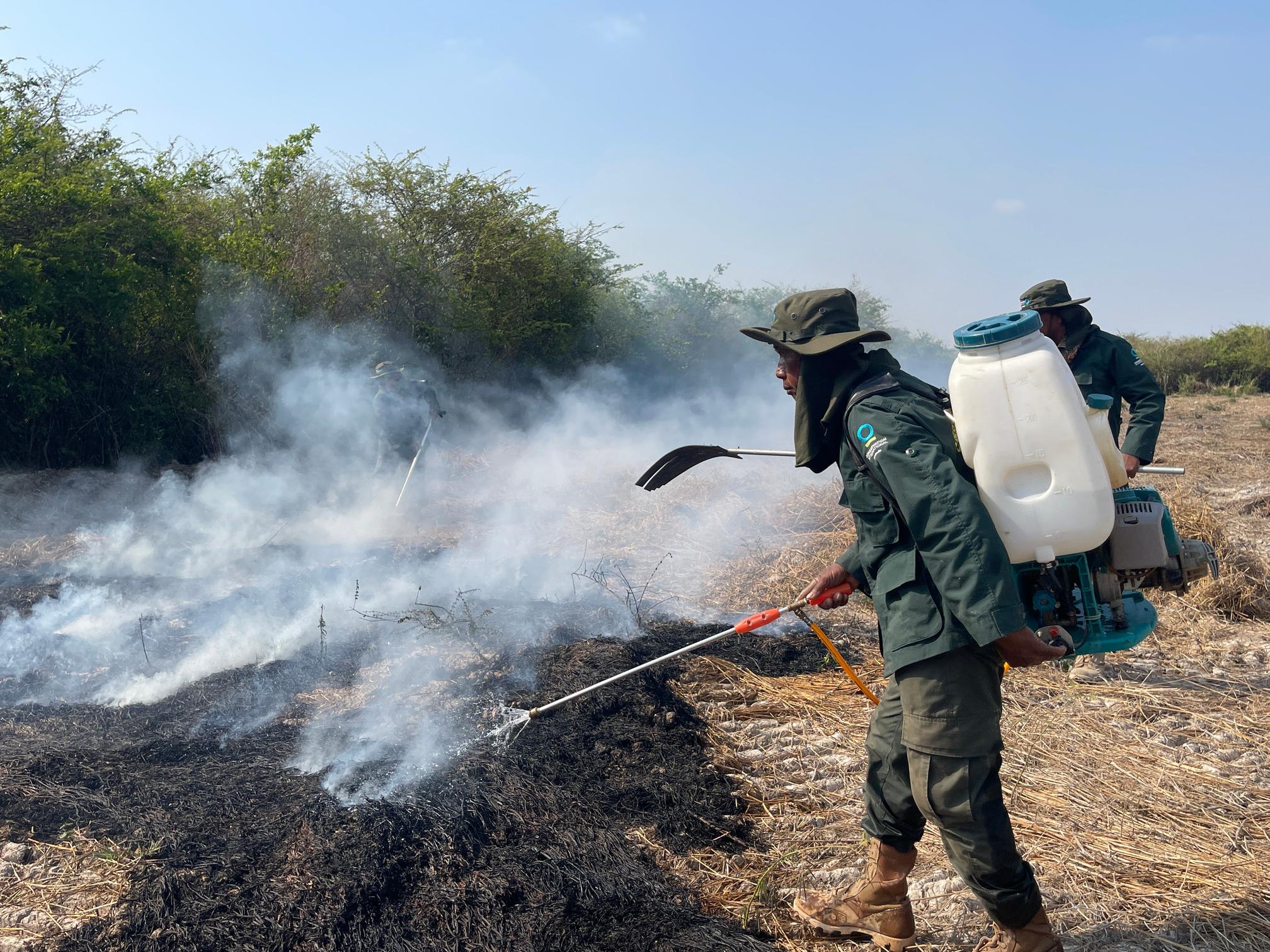
Luon Chanleng and fellow members of the Ou Taprok community patrol team didn’t wait. When a fire takes hold during the dry season, the difference between a contained blaze and a catastrophe is measured in minutes.
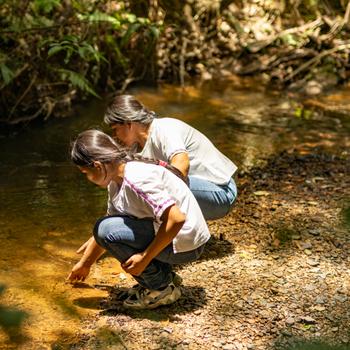
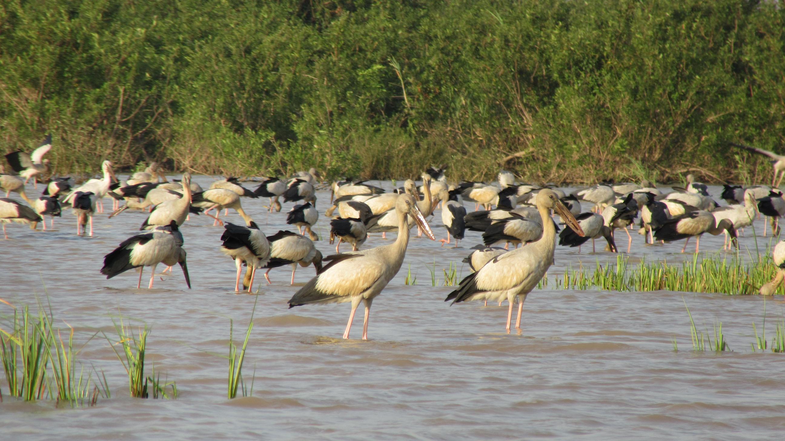
“The flooded forest is the nursery for fish and home of biodiversity,” he said. “When the forests are healthy, fish can breed and grow. But if the forest burns, the fish dwindle — and that affects the livelihoods of our whole community. I can’t imagine our life without the forest.”
Chanleng and his team moved fast, fanning out through the dry undergrowth to cut off the fire before it could spread. They had exact coordinates — dispatched automatically the moment a satellite detected heat in the forest. When they reached the fire, it was still small enough to fight. They put it out.
The fire alert came from a detection system piloted by Conservation International — one that is helping communities stop wildfires in a forest that hasn’t evolved to withstand them.
A tinderbox waiting for a spark
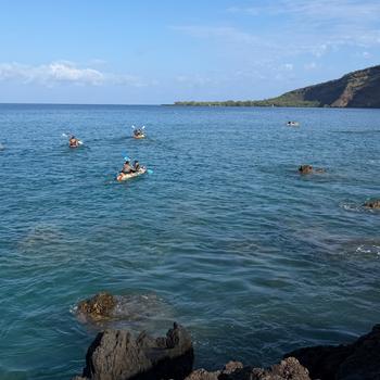
For much of the year, the flooded forests surrounding Tonle Sap, Southeast Asia’s largest freshwater lake, form a lush green canopy above reddish-brown water that teems with fish. But come January, when the dry season sets in, Cambodia’s great lake transforms. As waters recede, towering grasses that flourished during the wet season — growing up to nine meters (30 feet) tall — collapse over the forest floor, creating a dense carpet of fuel.
This is a seasonal cycle that is natural and ancient. But today, climate change has created longer and hotter dry periods. Rainy seasons have shortened by roughly an entire month over the past few decades. This has allowed fire to gain a foothold in a place that was historically too wet for a blaze to ever take off.
Overwhelmingly, these fires are caused by people. Fishermen accidentally ignite the dry grass with cooking fires or cigarette butts. Buffalo herders deliberately burn old grass to flush their livestock out of the forest and encourage fresh shoots for grazing when the rains return. Illegal fishers sometimes clear sections of forest to set their nets.
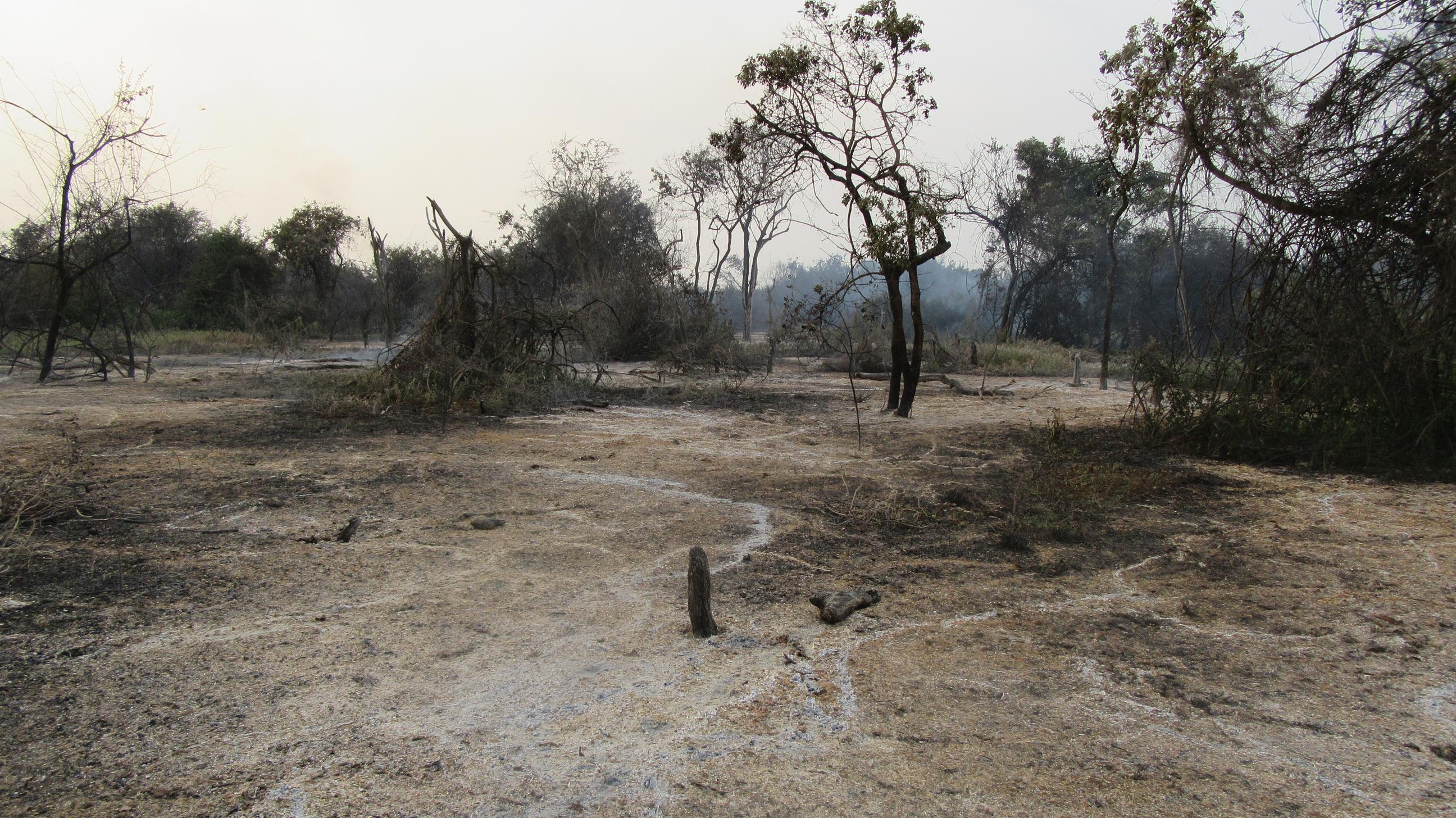
As human pressures persist, experts worry the problem may only get worse. Between 1993 and 2017, more than 30 percent of the Tonle Sap's flooded forests were lost to fire and agricultural clearing. As climate-driven droughts grow more severe, scientists warn that parts of the forest may transition into shrubland.
Fire is now an annual emergency, with consequences that ripple through the entire food web. The flooded forest floor is carpeted in organic muck — decomposed leaves and matter that make up the spawning ground for fish, snails and crabs. This nursery habitat is destroyed when fire burns through, releasing ash that turns the water thick and uninhabitable and drives away fish.
“If these forests burn, ash turns these waters thick and uninhabitable,” said Sokrith Heng, who leads the fire detection project for Conservation International-Cambodia. “And for a region where millions of people depend on the lake’s fisheries, every fire could become a food security crisis.”
Eyes in the sky
Speed, above everything else, is what separates a contained fire from a catastrophe, Heng said.
Fires don’t announce themselves. They start deep in the vast forest, invisible from the perimeter, spreading quietly through dry undergrowth before anyone on the outside can smell smoke. By the time a plume rises high enough to see, a patrol team is likely already outmatched.
In the past, Conservation International-Cambodia relied on an open-access fire monitoring system, but alerts could take hours to arrive — too slow to catch a fire while it was still containable.
In 2022, they partnered with OroraTech, a wildfire detection company whose satellites can monitor vulnerable areas in near real time. Now, within minutes of detecting a fire, alerts are dispatched to staff, who relay precise GPS coordinates to the 17 participating community groups across the region. So far, 70 community members have been trained and equipped to respond.
The results have been striking, Heng said. In three years, the program has stopped more than 50 wildfires and shielded 64,000 hectares (158,000 acres) of forest that millions of people depend on for food and shelter.
“The alert tells the teams exactly where to go while the fire is still containable with basic equipment,” he said. “But it’s the communities that make the real difference. When they receive timely information and have the skills and equipment to respond, they can stop small fires before they become catastrophic forest loss.”
The trust wasn’t assumed — it was built, Heng said. For two years, Conservation International staff validated every alert. When the technology showed an accuracy rate of 80 to 90 percent, the communities were convinced.
The stakes extend beyond fish populations and food security. Cambodia’s flooded forests rank among the region’s most biodiverse ecosystems, said Chanthorn Srorn, of Conservation International-Cambodia.
“We recently saw a fishing cat in Pursat for the first time in 15 years,” he said. “For me, that says everything. These forests, when we protect them, come back to life.”
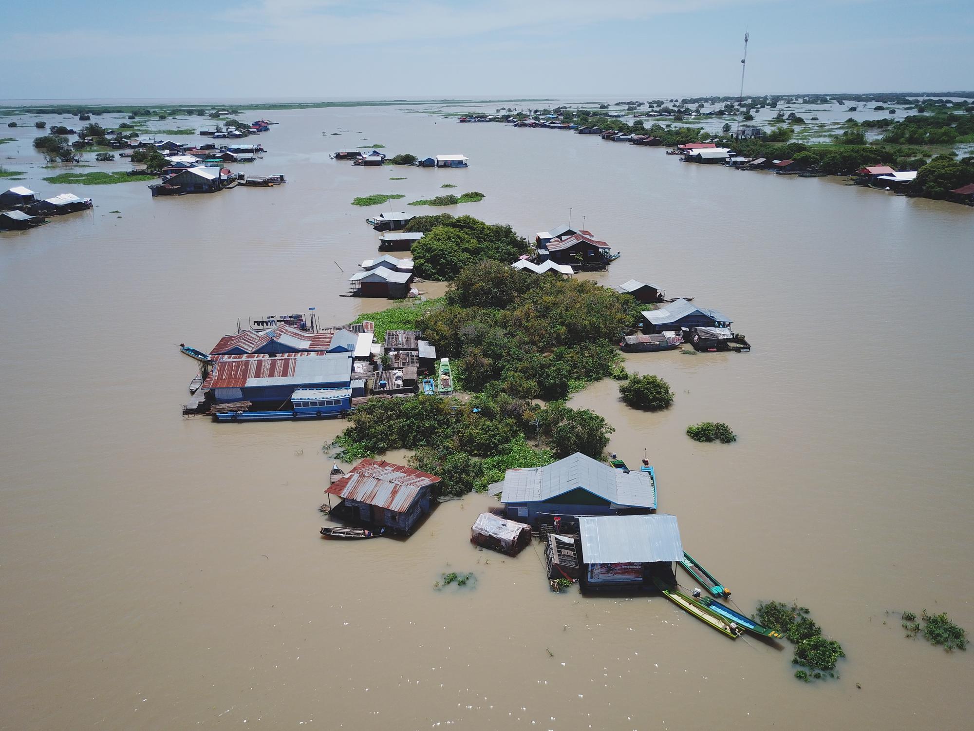
And for the thousands of families who live year-round in floating villages on the lake, the forest is not just an ecological resource. It’s a physical shield. When storms roll in, families maneuver their floating homes deeper into the forested areas to take shelter from the waves and winds. Lose the forest, and those families are left exposed.
The pilot has proven the model works, Heng said. Now, Conservation International is focused on scaling it across the full Tonle Sap region and along the Mekong River, where communities face the same seasonal fire pressures.
The ambition is larger than any single forest. It’s to show that communities, when given the right tools and trusted as partners, can become the most effective defenders of their homes.
“This combination of technology and local stewardship is essential for protecting what remains — and what can still be saved,” Heng said.